Satellite Technology for Climate Monitoring and Disaster Response
Live Registration
BATCH #24
03Seats Left
92% Booked
02
Days
:
00
Hrs
:
00
Min
:
00
Sec
Course Overview
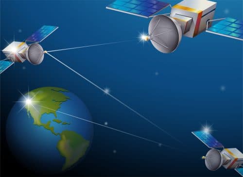
Satellite technology has become indispensable in monitoring climate change, providing real-time data that enables scientists and decision-makers to observe global temperature shifts, ice cap melting, and rising sea levels. In this program, participants will learn how satellite data is collected, analyzed, and interpreted to understand climate trends and create actionable insights for climate mitigation. The course covers essential satellite systems, remote sensing tools, and climate data processing techniques, equipping participants to track deforestation, desertification, and other environmental changes with precision.
Beyond climate monitoring, the program also focuses on the critical role of satellite technology in disaster response. Participants will explore how satellites are used to assess disaster impact, coordinate relief efforts, and monitor recovery in areas affected by natural calamities such as earthquakes, floods, and wildfires.
Program Syllabus
Module 1
About
Satellite technology has become indispensable in monitoring climate change, providing real-time data that enables scientists and decision-makers to observe global temperature shifts, ice cap melting, and rising sea levels. In this program, participants will learn how satellite data is collected, analyzed, and interpreted to understand climate trends and create actionable insights for climate mitigation. The course covers essential satellite systems, remote sensing tools, and climate data processing techniques, equipping participants to track deforestation, desertification, and other environmental changes with precision.
Beyond climate monitoring, the program also focuses on the critical role of satellite technology in disaster response. Participants will explore how satellites are used to assess disaster impact, coordinate relief efforts, and monitor recovery in areas affected by natural calamities such as earthquakes, floods, and wildfires.
Module 2
Aim
This program aims to provide participants with the knowledge and practical skills needed to apply satellite technology for climate monitoring and disaster response. It focuses on how satellite data can track climate change, predict extreme weather patterns, and assist in disaster management, offering innovative solutions for global environmental challenges.

Lead Instructor
Dr. Sarah Chen
PhD in Computational Mechanics from MIT with 15+ years of experience in Industrial AI. Former Lead Data Scientist at Tesla and current advisor to Fortune 500 manufacturing firms.
Limited SeatsClosing Soon
Satellite Technology for Climate Monitoring and Disaster Response
Professional Certification Program
🎥
FormatLive + Recorded
📅
Duration8 Weeks
📜
CertificationVerified
Module 3
Program Objectives
- Understand the role of satellite technology in climate monitoring and disaster response.
- Learn how to collect and analyze satellite data for environmental tracking.
- Explore satellite applications for disaster risk assessment and response coordination.
- Study real-world case examples of satellite use in disaster management and climate action.
Module 4
Program Structure
Module 5
Week 1: Introduction to Satellite Technology and Environmental Monitoring
- Fundamentals of satellite systems: Types, orbits, and sensors.
- Role of satellites in climate tracking and environmental monitoring.
- Overview of disaster management through satellite technology.
- Interactive session: Understanding satellite capabilities in global sustainability efforts.
Module 6
Week 2: Remote Sensing for Climate Monitoring
- Techniques for tracking climate change: Thermal imaging, multispectral, and radar sensing.
- Applications in sea-level monitoring, deforestation tracking, and urban heat island studies.
- Analyzing satellite data for identifying environmental trends.
Module 7
Week 3: Satellite Applications in Disaster Response
- Role of satellites in disaster prediction, assessment, and response coordination.
- Geospatial data for flood mapping, earthquake damage assessment, and wildfire tracking.
- Examples of satellite-assisted disaster management in global crises.
Module 8
Week 4: Practical Workshop and Case Studies
- Satellite data processing using tools like Google Earth Engine and QGIS.
- Interpreting satellite imagery for environmental and disaster scenarios.
- Case studies: Successful satellite interventions in climate action and disaster management.
Module 9
Intended For
- Undergraduate degree in Environmental Science, Aerospace Engineering, or Geography.
- Professionals in climate science, disaster management, or remote sensing.
- Individuals with a keen interest in satellite technology and environmental sustainability.
Module 10
Program Outcomes
- Mastery of satellite data collection and analysis for climate and disaster applications.
- Practical skills in using remote sensing tools for real-time environmental tracking.
- Understanding of how satellite technology improves disaster preparedness and response.
- Knowledge of satellite systems and their impact on climate monitoring and mitigation.
- Ability to apply satellite data for global environmental protection and disaster relief efforts.
Module 11
Fee Structure
Standard Fee: INR 8,998 USD 198
Discounted Fee: INR 4499 USD 99
We are excited to announce that we now accept payments in over 20 global currencies, in addition to USD. Check out our list to see if your preferred currency is supported. Enjoy the convenience and flexibility of paying in your local currency!
List of CurrenciesModule 12
FOR QUERIES, FEEDBACK OR ASSISTANCE